Beyond Skinwalker Ranch: Mysterious Bridge Contains Dimensional Portal
Beyond Skinwalker Ranch: Mysterious Bridge Contains Dimensional Portal

Well, guys, it’s great to have you back at the ranch with us.
What do you got for us?
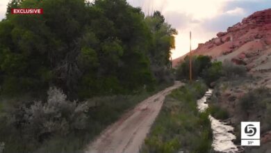
So we want to go back to one of the most compelling locations from our first round of investigations, Miller Ranch, a place in Southern Colorado.
After everything we saw at Miller Ranch last time, I know follow up is in order.
Yeah, there’s clearly something going on there.
– Pete. – Good to see you, sir.
Hey, Andy.
Great to have you.
Yeah, good to be back.
Yeah, you look like you’re ready to rumble, man.
[laughs] NARRATOR: Skinwalker veteran Pete Kelsey has used advanced drone and LiDAR technology to survey and map anomalies at Skinwalker Ranch.
Now, Andy and Paul hope Pete Kelsey’s equipment and expertise will uncover more answers about the Miller Ranch bridge and its similarity to the Skinwalker Ranch triangle.
What you see over here is essentially the triangle of the Miller Ranch.
This is the center point of our investigation on this property.
Wow.
We’ve measured magnetic anomalies, radio frequency anomalies, we’ve even seen UAPs on this exact location.
– Really? – Yeah.
Well, that sounds like the triangle I know.
Exactly.
NARRATOR: For this experiment, Pete Kelsey will be flying a photogrammetry drone over the Miller Ranch bridge.
Pete used the same equipment at Skinwalker Ranch in 2021 to capture an anomalous spire over the East field.
Look at this phantom structure that’s sticking up in the sky.
It looks more than a hundred feet in the air.
That’s nuts.
So as you pass the bridge, that’s going to be scanning essentially across it.
Right.
Basically at an angle.
NARRATOR: A photogrammetry drone flies on a pre-programmed flight path to capture thousands of high-definition pictures in the target zone, combining them to create a detailed 3D image that can reveal anomalies not seen by the naked eye.
It really paints the whole three-dimensional picture.
Exactly.
NARRATOR: The team hopes the photogrammetry survey might help explain what Travis suspects could be a doorway over the Miller Ranch bridge.
I’m good to go.
So Pete, we’ve got a spectrum analyzer set up, so we’ll be watching to see if your flight triggers any kind of effects in the radio spectrum.
Great. OK.
So before we even get started, it looks like our spectrum is looking good. We’ve got some general noise.
I’m focused in on the 1.6 gigahertz range.
It looks like it’s kind of all quiet on the Miller Ranch front right now. – Absolutely.
We’re very much in a normal baseline environment right now for radio energy.
Interesting.
Until we start poking the hornet’s nest.
All right, we’re ready for you, sir.
So this is our flight pattern that we’re about to fly.
Is that right, Pete?
That’s right.
Taking off.
[suspenseful music] All quiet so far, Andy?
Yeah, everything looks normal so far.
Yeah.
I’m working my way through 1.6 gigahertz all the way up to 1.8 gigahertz.
And I’m tracking to see if there’s any variance in our baseline and I’m also tracking for spikes.
Right.
And to see if those spikes correlate with the flight pattern of the drone like when it crosses our bridge.
So if anything pops on the analyzer now– If anything pops like that, hold on, what’s this?
Right over the bridge.
Look at that.
The fact that that spike is there at all, it just shouldn’t be there.
We’re quickly approaching center align– Directly overhead.
–the bridge, yeah.
And approaching the bridge.
Oh, there it was. There it was.
Did you see it? – I did.
I saw that bounce.
Right over the bridge. Look at it.
Look at it.
Almost centered on the bridge, too.
So that’s a second time now that we’ve seen the drone transit above the bridge– And get a spike.
–and get a spike in energy specifically at 1.695 gigahertz.
What– I mean, what could that possibly mean?
This is the center line– Right down the middle– –of the mission. We see that.
Let’s see.
As it approaches the bridge, it’s kind of a moment of truth right here.
[suspenseful music] There it was again.
There was another spike. – Look at where we are.
Look where we are. – There we go.
The spikes are momentary.
Yeah, just a flicker.
I mean, something has to be generating that.
That’s not– – Exactly.
Yeah.
All evidence points to the bridge.
So I’m mission complete.
Landing, guys.
OK.
So the photogrammetry mission is complete.
I want to see now what happens when we look at the results of the photogrammetry.
– So do I. – OK.
Let’s do it.
Let’s get to work.
So I’m going to show you what I have.
[laughs] So this is the photogrammetry data.
This is the bridge.
You can tell where you are.
Sure.
So the photogrammetry tool is looking at the visible spectrum only, right? – Only.
It’s basically photographs, digital photographs taken from a drone from the air.
It can create depth, so you get three-dimensional data like this.
This is crazy.
Everything looks just fine.
What is that?
Those are underground pictures.
Yeah.
What is that?
And it’s only over the bridge.
Look at that.
Yeah, there’s just a huge concentration– How would photogrammetry pick up a data point underground?
And not to beat on the obvious but two different sensors, LiDAR and just RGB camera, photogrammetry, there’s data underground.
It’s not possible.
Yeah, there’s a lot of it.
And it’s only at the bridge and both datasets are in the same area.
What we’re seeing is impossible.
It’s not possible.
OK.
Also, this anomalous data that’s in the air, it shouldn’t be there.
And I’ve only seen this one other place.
Do you remember the photogrammetry spire in the East field?
Yeah.
Skinwalker Ranch?
Yes.
This is the same drone, the same camera, same software, same everything.
It’s just a different location.
And it’s the only two times I’ve seen these kind of results.
That to me is the craziest part.
Two completely different sensors getting daily returns where it can’t possibly be.
Right.
Above ground or underground?
And to hear that a number of accidents, fatal accidents sort of correspond to some of this, that gives me the willies, frankly.
We have to also remember that during our first trip here, we saw a UAPs above this bridge.
Right, at this spot.
Yeah.
And Travis and Eric have even asked us the question, could this be some sort of entry point for whatever phenomenon may be leading to the cattle mutilation?
Pete, this is awesome.
Thank you so much for coming out and making time to do this.
Yeah, it’s– well, it certainly has been interesting.
So I want to share with you the results of what Pete got with photogrammetry.
Oh, yeah.
So let us talk to you about how photogrammetry works.
So it’s over a point.
It takes a bunch of pictures at that point.
It knows the angle of the camera, scanning mirror, and then it moves to the next point.
But it measures with GPS.
That’s the key.
Which GPS measures its position by precise time measurements.
And if this spot on the ground from this point, it should be registered to be right there.
But if it shows up somewhere else, then the drone thought it was somewhere else when it took that particular image.
And if it thought it was somewhere else, then the time measurement for its position was off.
So again, it comes down to the measurement of time.
All right, what are we talking about here?
So are we saying that two different tools, two completely different technologies in the same location are giving potential evidence of some sort of potential time anomaly?
We’ve seen that.
Yes, yes.